
A colleague of mine just returned from overseas where he flew a UAV as part of an independent exploratory project. He did so with permission and also engaged directly with local communities in the process—as per the guidelines listed in the Humanitarian UAV Code of Conduct. He subsequently sent me this aerial video footage of a camp, which he recorded using a DJI Phantom 2 Vision+:
The analysis of aerial imagery for humanitarian & development purposes is an active area of research at UAViators. He thus kindly gave me permission to share this footage with colleague Matt Shroyer so that we could explore the possibility of creating a mosaic and 3D model from the video.

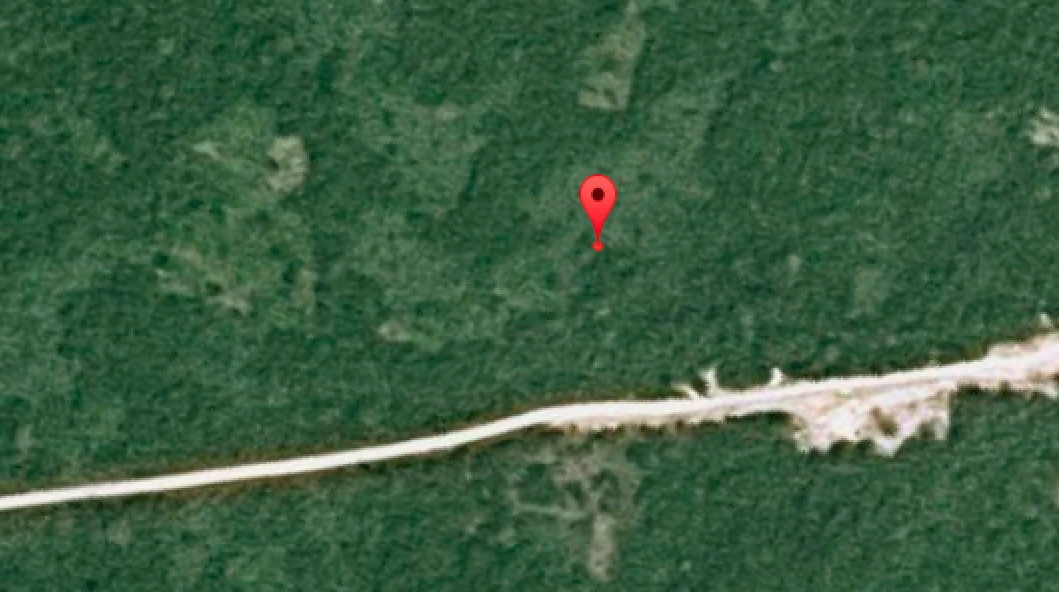
Incidentally, the image below is the highest resolution and most recent satellite image available of the camp on Google Maps. As you can tell, the satellite image is very much out of date.
And here is the mosaic, which Matt kindly produced by taking hundreds of screenshots of the aerial video footage (click to enlarge):
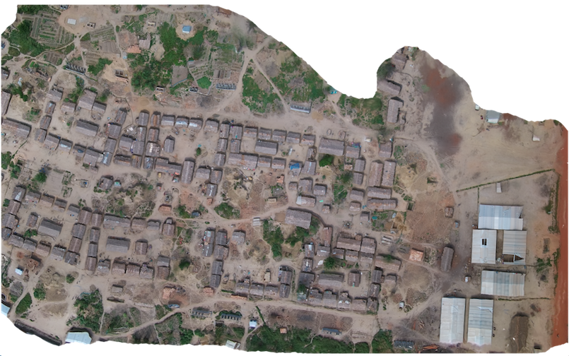
A close up:

We then explored the possibility of creating a 3D model of the camp using the screenshots and SketchFab. The results are displayed below (click to enlarge). The numbers are annotations we added to provide relevant information on the camp. Perhaps in the future we’ll be able to add photographs & videos (captured from hand-held cameras) and other types of data to the 3D model.


It’s worth noting that this 3D model would be far higher resolution if the UAV had been flown with the expressed purpose of creating a 3D model. Either way, you’ll note that no individuals appear either in the mosaic or in the 3D model, which is important for data privacy and security.
Here are two short video fly-throughs of the 3D model:
You can also fly through the model yourself here.
The purpose of this visual exploration is to solicit feedback from humanitarian organizations vis-a-vis the potential added value that this imagery could provide for camp management and related humanitarian efforts. So please feel free to get in touch via email and/or to post comments below with your feedback. In the meantime, a big thanks to my colleague for sharing the aerial videos and equally big thanks to Matt for all his time on the imagery processing. UAViators will be carrying out additional projects like this one over the coming months. So if you’d like to get involved, please do get in touch.

Good stuff. How was the elevation information derived for the 3D model?
Thanks, we simply used PhotoScan on the screenshots of the videos to derive the 3D model.
Pingback: Point Cloud Survey and its Role in 3D BIM Modeling Services | Internet Billboards
Very cool – what model UAV was used?
Thanks, DJI Phantom 2 Vision+
Very interesting thanks! The screenshots were derived manually or did you use any specific software / do you know if there is software available for that?